The following advertisement appeared in the New York Mercury on June 22, 1756.
This is to give notice to all able-bodied freeman, not inhabitants of the county of Suffex, who are willing to enter into the fervice of the province of New Jersey, in defending the frontier parts of said province, that on their application to me the fubfcriber, at Fort John’s or elfewhere in the county of Suffex, they shall immediately be inlisted, and be upon the province pay, at TWO SHILLINGS, Proclamation money, per day.
Jacob DeHart, Commander of the Forces of frontier fervice.
(The letter “S” was very often displayed as ” f ” during this period of history).
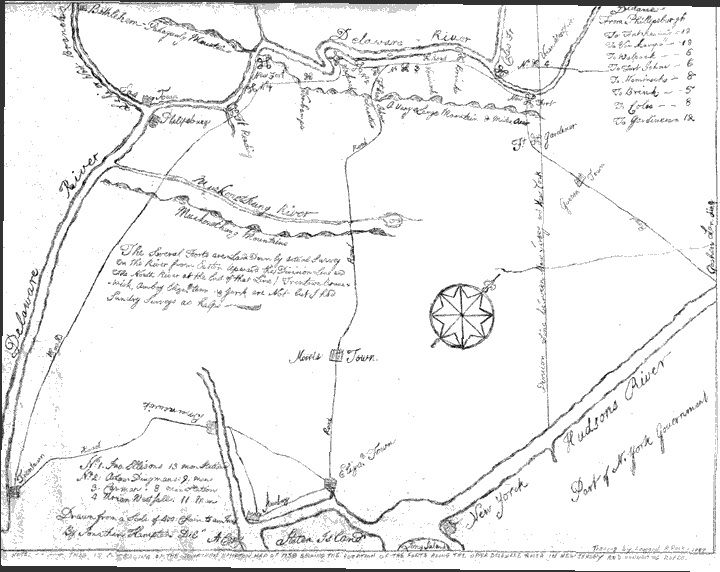
At the time of the French and Indian war the population of New Jersey largely was centered around Atlantic seaports in Elizabethtown (present-day Elizabeth, New Jersey), Newark and Perth Amboy and the colonial legislature authorized the construction of blockhouse forts in the area of present-day Sussex and Warren Counties, New Jersey to serve as a first line of defense in the event of an incursion by the French army and the forces of French-allied Indian tribes.
The New Jersey Frontier Guard was organized to man those forts as the state militia fought elsewhere within the colonies of Virginia, Pennsylvania , New York and as far away as Cuba.
The area where these blockhouse forts were constructed was composed of sparsely populated frontier settlements that were subjected to frequent raids and attacks by Indian warriors.
Supplies were provided to the Frontier Guard from Elizabethtown, transported by way of the Military Road.
The Military Road (also known as the Military Supply Road) was built to connecting Elizabethtown (now Elizabeth) with the string of fortifications along the Delaware River in northwestern New Jersey.
The road was conceived and built under the order of Jonathan Hampton, Esq., an Elizabethtown merchant and surveyor who was appointed as Victualer and Paymaster to the New Jersey Frontier Guard by an act of the New Jersey's colonial legislature.
Most of the route has been converted into roads within the federal, state and county highways system, and into a few local, municipal roads.
A one-mile (1.6 km) segment of the original road, runs from the village of Walpack Center in Walpack Township, New Jersey to the terminus of the route at the Delaware River within the bounds of the Delaware Water Gap National Recreation Area and is maintained in its original condition.
